The Copernicus Data Space Ecosystem has published a case study on UDENE, showcasing how Earth Observation can help cities explore development ideas before a single decision is made.
What if urban planners could see how an idea might play out — a new ring road, a network of parks, a cluster of high-rises — before committing budget and breaking ground? That question sits at the heart of UDENE (Urban Development Explorations using Natural Experiments), a Horizon Europe Research and Innovation Action supported by the European Union Agency for the Space Programme (EUSPA). The project has now been featured as a case study on the Copernicus Data Space Ecosystem (CDSE), the official gateway to Copernicus satellite data.
Turning urban interventions into “natural experiments”
Urban planning still leans heavily on historical records, local surveys and small pilot studies — sources that are hard to compare from one city to the next and that struggle to keep pace with how fast cities and the climate are changing. UDENE offers a different starting point.
Its core insight is that an urban intervention is, in effect, a real-world experiment whose consequences leave a trace in satellite data. If a development idea has already been tried somewhere else, or at another moment in time, that outcome can be observed and learned from. UDENE calls these natural experiments.
The approach draws on Copernicus Earth Observation data — including Sentinel-2, Sentinel-3 and Sentinel-5P — organised into a thematic data cube that makes large volumes of satellite imagery ready to analyse in minutes rather than weeks. A planner defines an idea and the outcome they hope it will deliver (for example, “a linked park system” to “reduce urban heat islands”). The system then scans comparable areas across the globe, filters out the ones that are not genuinely similar, and surfaces the places where the outcome is unexpectedly favourable. Those outliers become candidates worth studying more closely.
A companion matchmaking tool rounds out the picture: while the search runs, it points users to European Earth Observation products and services relevant to their idea, connecting local planning challenges to the European space sector.
Three cities, three questions
The case study demonstrates the methodology through three use cases in Copernicus International Partner Countries, each tackling a different urban challenge:
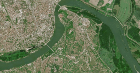
- Novi Sad, Serbia — Does a ring road and pedestrianisation reduce traffic-related air pollution? Sentinel-5P nitrogen dioxide readings are compared against cities of similar density and structure.
- Tunis, Tunisia — Can an interconnected network of green spaces ease the urban heat island effect? Sentinel-2 vegetation indices and land surface temperature data are compared across districts with similar climate zones.
- Istanbul, Türkiye — How does high-rise development affect potential earthquake losses? Building and seismic-risk data are combined to compare cities with similar exposure.
Two cascade funding Open Calls extended the work further, embedding UDENE tools into geodata science education and testing them in real business cases across the three partner countries.
Read the full case study on the Copernicus Data Space Ecosystem: The UDENE project: Evaluating urban development concepts through Earth Observation data