• Home
  • About
    • UDENE Project
    • Granting Authority
    • Who is who?
    • Partners
  • Tools & Services
    • Exploration Tool
    • Matchmaking Tool
  • Use Cases
    • Türkiye
    • Tunisia
    • Serbia
  • News & Events
  • Publications
  • Open (FSTP) Calls
  • Contact

Course on Geological Remote Sensing for Exploration and Mining by NiK System

Posted on 01/15/2025
No Comments

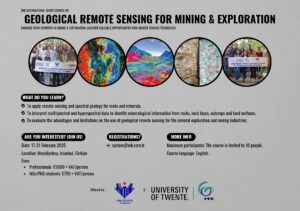
Join UDENE consortium partner NiK System for a unique course on ‘Geological Remote Sensing for Exploration and Mining ‘ to enhance your expertise and uncover valuable opportunities with Remote Sensing technologies.

The course will take place at NiK System’s offices in Istanbul and will be organised in cooperation with the ITC Faculty of the University of Twente. It will include both theoretical and practical studies on hyperspectral and multispectral satellite imagery and processing and will be held in English.


When? 17 February to 21 February 2025

Where? Mecidiyekoy, Istanbul, Türkiye


The course is limited to 10 participants!

Send an email now to: system@nik.com.tr to register. 


Fees

  • Professionals: €1,000 + VAT/person
  • MSc/PhD students: €750 + VAT/person


More information below ⤵️


Previous Post
UDENE at the EO for Africa Symposium 2024
Next Post
UDENE at DISC 2024

Leave a Reply Cancel reply

Your email address will not be published. Required fields are marked *

Fill out this field
Fill out this field
Please enter a valid email address.
You need to agree with the terms to proceed

Recent Posts

  • UDENE, DINOSAR, and COMUNIDAD: Strengthening Synergies in Earth Observation for Sustainable Development March 31, 2025
  • Exploring Satellite Data: A Seminar at ENET’COM March 28, 2025
  • UDENE at ISPRS, EARSeL & DGPF Joint Istanbul Workshop February 24, 2025
  • UDENE at Mining Industry Technology Days February 24, 2025
  • Copernicus Highlights EU-funded Projects February 4, 2025

Categories

  • Events (5)
  • News (15)

UDENE PROJECT

The UDENE Project aims to use large amounts of Earth Observation (EO) data from Copernicus satellites and local sources to support evidence-based decision making for urban development, especially in international partner countries. To support the UN Sustainable Development Goal 11 of making cities safe, resilient, and sustainable, the project will essentially create a virtual laboratory for urban planners and visionaries to test their development ideas.

Recent Posts

UDENE, DINOSAR, and COMUNIDAD: Strengthening Synergies in Earth Observation for Sustainable Development
Exploring Satellite Data: A Seminar at ENET’COM
UDENE at ISPRS, EARSeL & DGPF Joint Istanbul Workshop

Contacts

info@udene.eu

Social Media

Facebook
Twitter
LinkedIn
Instagram

Visitor Count: 573

© UDENE Project 2025