• Home
  • About
    • UDENE Project
    • Granting Authority
    • Who is who?
    • Partners
  • Tools & Services
    • Exploration Tool
    • Matchmaking Tool
  • Use Cases
    • Türkiye
    • Tunisia
    • Serbia
  • News & Events
  • Publications
  • Open (FSTP) calls
  • Contact

Exploring Satellite Data: A Seminar at ENET’COM

Posted on 03/28/2025
No Comments

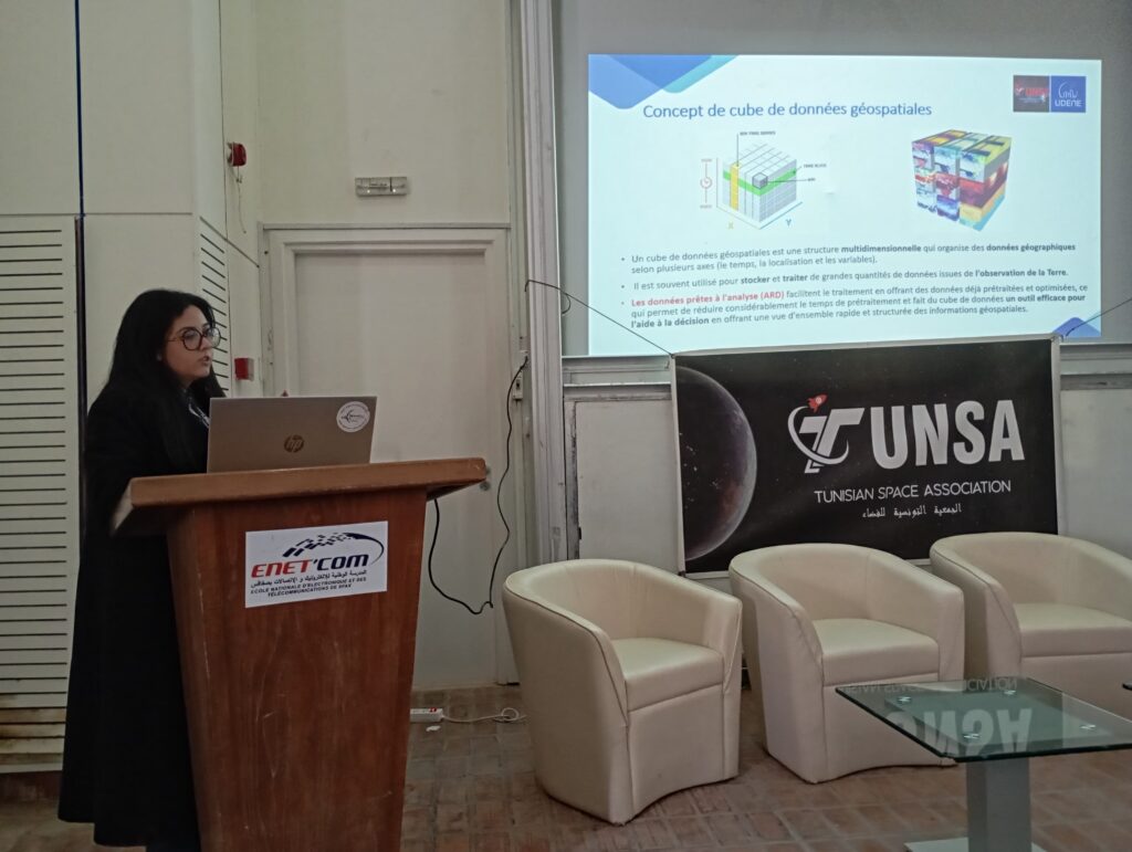
The TUNSA Club at the École Nationale d’Électronique et des Télécommunications de Sfax (ENET’COM), University of Sfax, recently organized a seminar titled “Exploration des données satellites” (Exploring Satellite Data). This event aimed to introduce engineering students to Earth observation satellites, their data, and their applications in addressing real-world challenges, such as climate change.

Held in partnership with the Franco-Tunisian company Climate Innov, the seminar provided students with a valuable opportunity to deepen their understanding of satellite technology and its impacts. Experts in the field shared insights on how satellite data is leveraged for environmental monitoring, disaster management, and sustainable development.

The event featured informative presentations, engaging discussions, and practical examples demonstrating the significance of satellite data in today’s world. Participants gained hands-on knowledge about data processing techniques and the role of satellite imagery in tackling global environmental issues.

Additionally, the UDENE project was presented during the seminar, highlighting its contributions to the field of satellite data exploration and its role in developing solutions in the realm of sustainable development, with a special focus on our three use cases.

Through initiatives like this, the TUNSA Club continues to promote awareness and technical expertise among students, preparing them for future careers in space technology, remote sensing, and environmental science.

Post Views: 221
Previous Post
UDENE at ISPRS, EARSeL & DGPF Joint Istanbul Workshop
Next Post
UDENE, DINOSAR, and COMUNIDAD: Strengthening Synergies in Earth Observation for Sustainable Development

Leave a Reply Cancel reply

Your email address will not be published. Required fields are marked *

Fill out this field
Fill out this field
Please enter a valid email address.
You need to agree with the terms to proceed

Recent Posts

  • 5 Days Left to Apply for the UDENE Open Calls! August 24, 2025
  • UDENE Open Call 1 Deadline Extended to 31 August 2025 August 16, 2025
  • Cities in Focus: Webinar Series Now Available on YouTube August 3, 2025
  • Want to Learn More About UDENE’s Open Calls? Join Our Live Info Sessions This August! August 2, 2025
  • Apply Now: UDENE Open Calls to Advance Geodata Science and EO Business Solutions July 30, 2025

Categories

  • Events (7)
  • News (19)

UDENE PROJECT

The UDENE Project aims to use large amounts of Earth Observation (EO) data from Copernicus satellites and local sources to support evidence-based decision making for urban development, especially in international partner countries. To support the UN Sustainable Development Goal 11 of making cities safe, resilient, and sustainable, the project will essentially create a virtual laboratory for urban planners and visionaries to test their development ideas.

Recent Posts

5 Days Left to Apply for the UDENE Open Calls!
UDENE Open Call 1 Deadline Extended to 31 August 2025
Cities in Focus: Webinar Series Now Available on YouTube

Contacts

info@udene.eu

Social Media

Facebook
Twitter
LinkedIn
Instagram
YouTube

Visitor Count: 4,862

© UDENE Project 2025